Not another guidebook…
… was the first reaction I had to being presented with an idea for my eleventh book.
My relationship with Amberley stretches back to well before its inception; a multitude of contacts and people I’ve grown to rely on when penning a new project.
The pandemic, like many people, forced me inwards and once Secret Yorkshire Dales had been published, I felt I’d completely frazzled my creative juices and decided to take a gap between drinks.
But the Yorkshire Dales continued to weigh on my mind and, punch drunk, I wandered back in, wondering if there was another angle I could tap into.
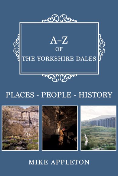
The team at Amberley suggested the popular A-Z series and I have to admit I was pensive. Cramming the breadth of the Dales into a handy ‘cut and keep’ A to Z guide is not an easy task. What do I include, omit, or go into detail about?
Yet, that’s what I did; visiting and researching areas of this fantastic national park I hadn’t experienced. It re-ignited my passion for this special place once again.
Hopefully, the book demonstrates my love of what I call my second home; the place in which I spend most of my time working and breathing. I’ve included some of my favourite dales and spoken to cavers, farmers, and those entrusted with protecting this special place.
Of course, those omissions! Readers will almost certainly note that I’ve not included every dale within the Yorkshire Dales National Park, nor every mountain, or honeypot site. I wanted it to be an A to Z of things special to this national park; seldom found anywhere else in Britain.
So, to whet your appetite, here are some opening snippets of my favourite chapters:
Commoning
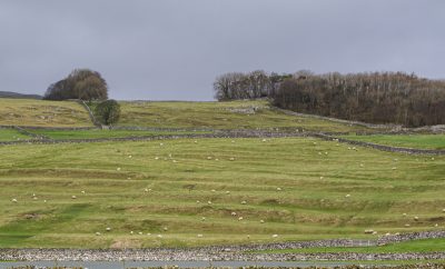
The Yorkshire Dales is a working landscape that has been framed by industries such as mining and farming ever since humans settled. One ancient agricultural practice is ‘commoning’, where farmers graze their sheep on common land in the uplands. In the Dales, this method is somewhat threatened as areas of land are turned over for tree planting and natural regeneration. Historically, the commons were important as they allowed people to scrape a living by being self-sufficient on small areas of land, and then graze their animals on the uplands. As common land was enclosed to increase the efficiency of agriculture to feed a growing population, it was these local small holders who lost out…
Dancing Flags
Dent is packed with heritage amongst narrow, cobbled streets that could be straight out of a film set. Just to the north of the village is Flintergill. Head upwards out of the village green to a steep climb that eventually breaks free to provide great views of Barbondale and beyond. The gill is also climbable for those more adventurous … in dry weather, of course.
Just before the route lifts is an obvious path to the left which takes you to an open pavement of limestone, right in the gill itself. These dancing flags would have been a hive of activity in the eighteenth and nineteenth centuries as women pulped cloth on them with their feet…
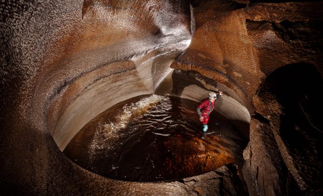
Ease Gill
Stretching some 90 kilometres, the Three Counties cave system is British caving’s jewel in the crown. For a long time, the thought of physically connecting passages across Yorkshire, Lancashire, and Cumbria has been the work of ardent mud lovers who stoically toiled in tight passages to make breakthroughs and extend the system.
But the thought of making a Three Counties trip itself was the stuff of folklore. Such a journey would see the explorer undertake many dives in brown, peaty water and negotiate a multitude of dry passages. They’d also need to be fit as a fiddle to climb and descend ropes and have a team of like-minded speleo fans to provide backup support.
On 25 September 2021, two cavers did just that. Jason Mallinson and Chris Jewell entered Large Pot in Kingsdale at 11 a.m. to traverse the system through to Top Sink in Ease Gill. The preparation to complete such a task was immense. Some of the connecting dives had never been completed as a through trip – having been dived from the opposite side – and new routes had been discovered. Then there was the sheer number of climbs and pitches that needed to be pre-rigged. Transporting gear was a mammoth task…
Scaleber Force
Drivers on the route out of Settle to Malham wouldn’t know this wonderful waterfall was here unless they’d pre-planned a visit or took a punt after seeing a few cars parked up. It’s not signposted and only a small Woodland Trust ‘Scaleber Wood’ marks the spot … kind of. Trust your instincts and descend the tricky path. Here, Stockdale Beck falls 40 feet into an amphitheatre of woodland, thanks to the action of water. It has eroded the limestone, which is on the South Craven Fault, into a deep gorge. Drink it in, there’s nothing to do but watch the waterfall tumble over the rocks in a beautiful setting.
Yeti
When you’re researching an area you love a great deal, one you’ve walked over and been part of for years, you’d think there’s nothing left about it that would surprise you. Well, in late 2022, I was sent a short video clip of British cryptids – animals that some people believe may exist in the wild but are not recognised by science – and I was taken aback. Apparently, one of these has been apparitions was sighted in the country, moreover in the Yorkshire Moors, and it’s called the Yorkshire Yeti. The video entitled British Cryptids: Yorkshire Yeti was released in 1974 but only seems to have been ‘shown at schools or languished in public libraries’, according to the poster. It starts with the line ‘between 1956 and 1961, over twenty sheep worrying incidents were said to have been due to the actions of the Yorkshire Yeti’, and then discusses mutilated sheep carcasses that haunt shepherds to this day…
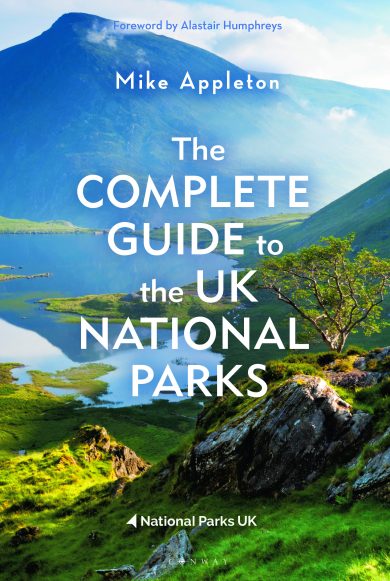
To grab your signed copy of A to Z of the Yorkshire Dales, click here.

